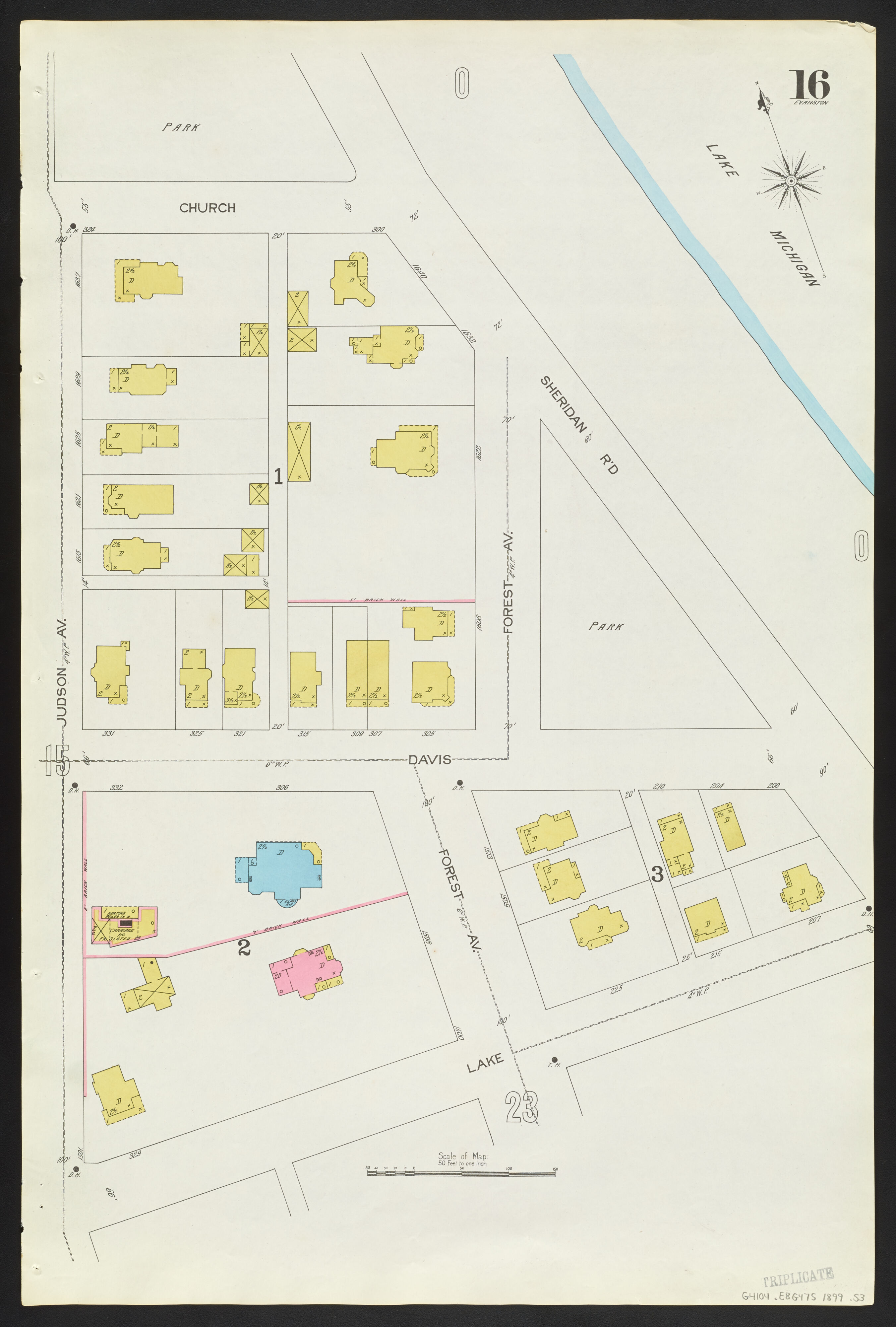
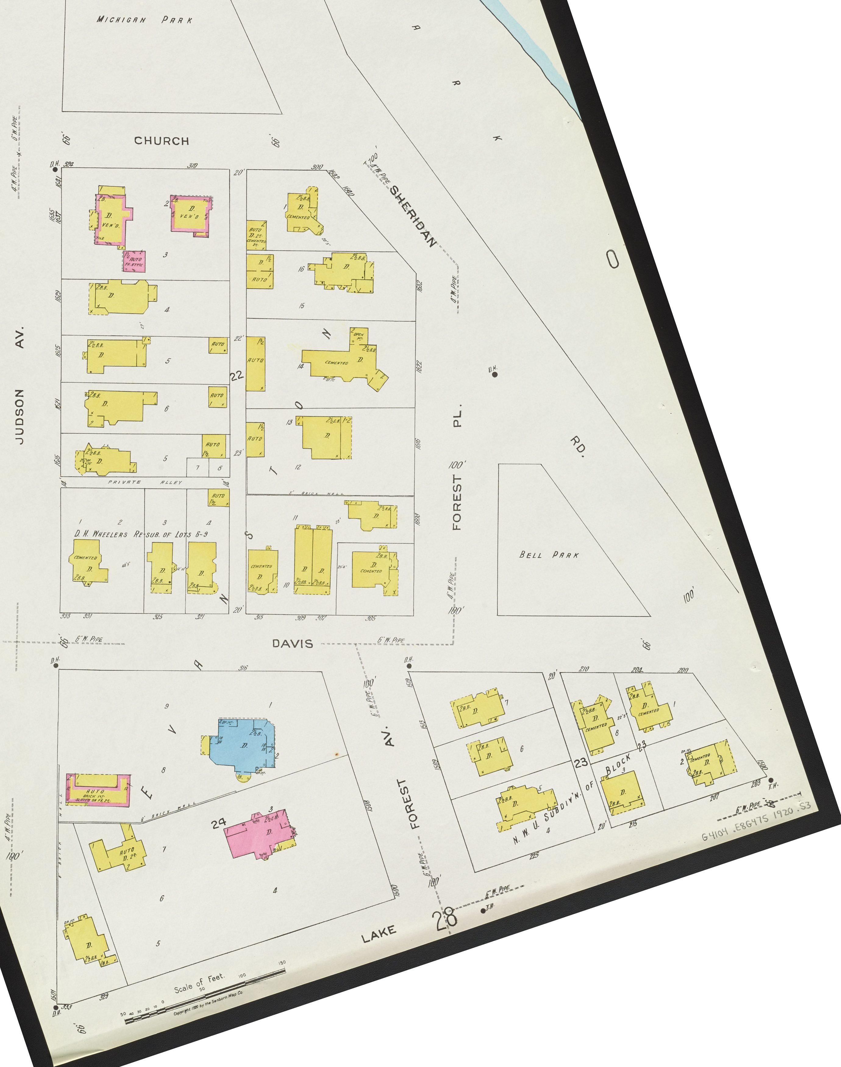

Sanborn Maps
We use Sanborn maps on a regular basis. What are they?
"Sanborn maps are detailed maps of U.S. cities and towns in the 19th and 20th centuries. Originally published by The Sanborn Map Company, the maps were created to allow fire insurance companies to assess their total liability in urbanized areas of the United States." from Wikipedia.
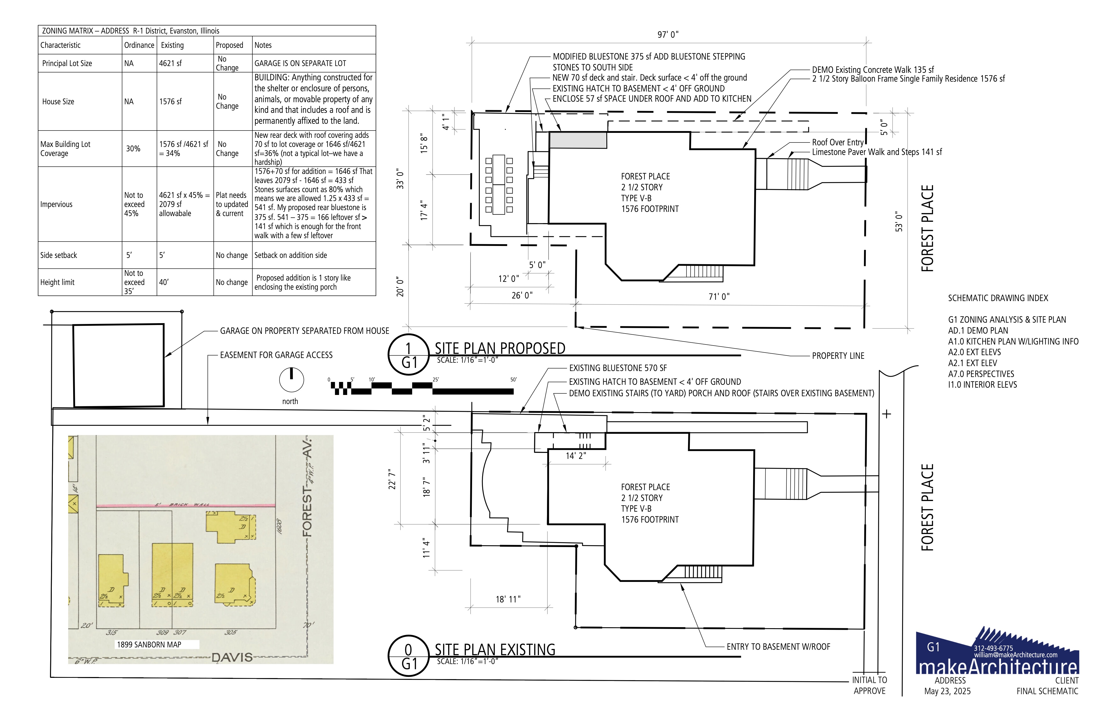
We were doing a small addition for a new kitchen on a beautiful house fronting Lake Michigan. There were some peculiar aspects of the lot such as the garage was connected by the walkway width of a sliver of land at the alley. The 1899 map shows a house smaller than the present day one and it appears to be older than the others. Portions of the original lot were sold off and by 1920 the house is crowded between more neighbors.
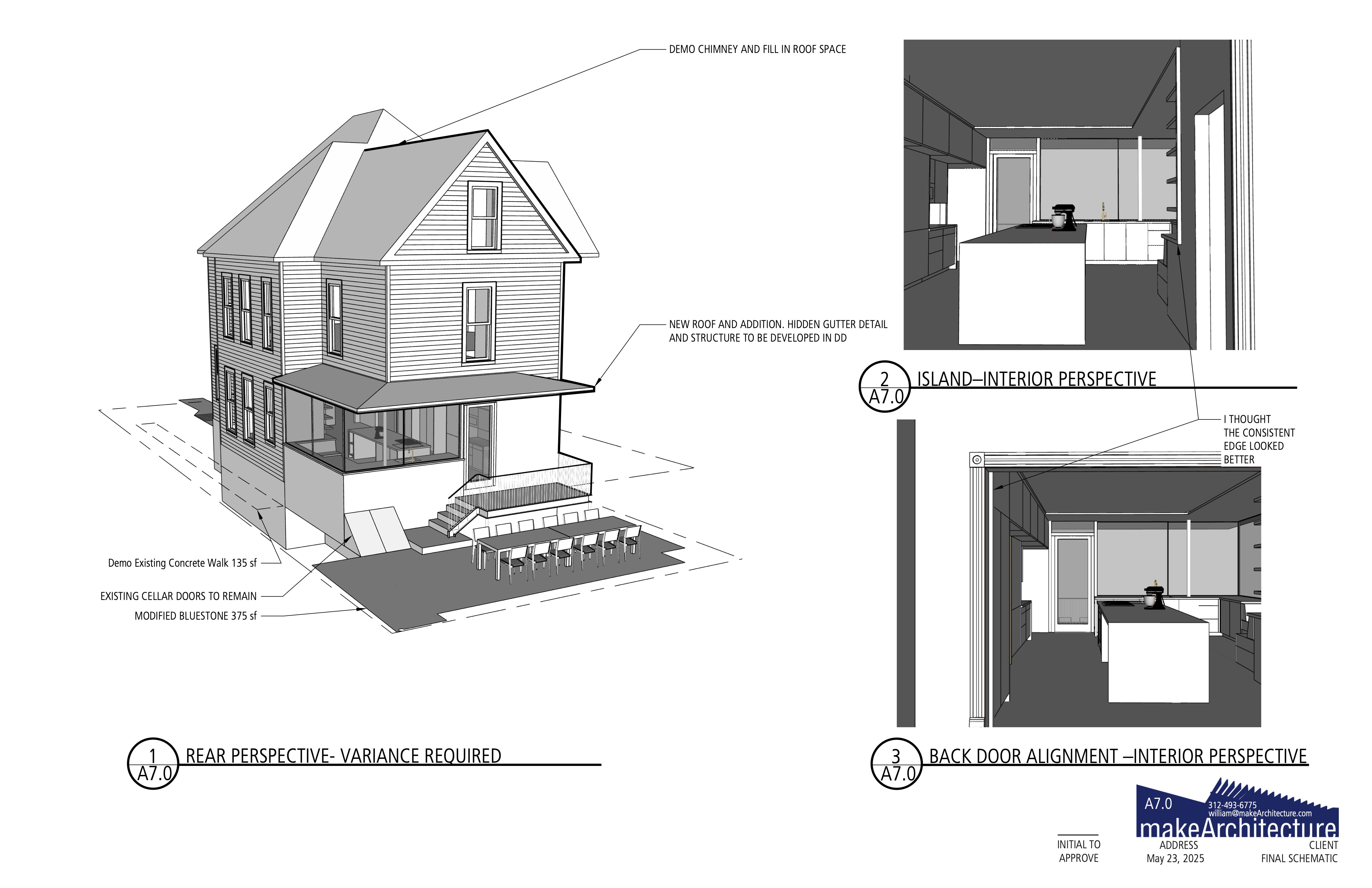
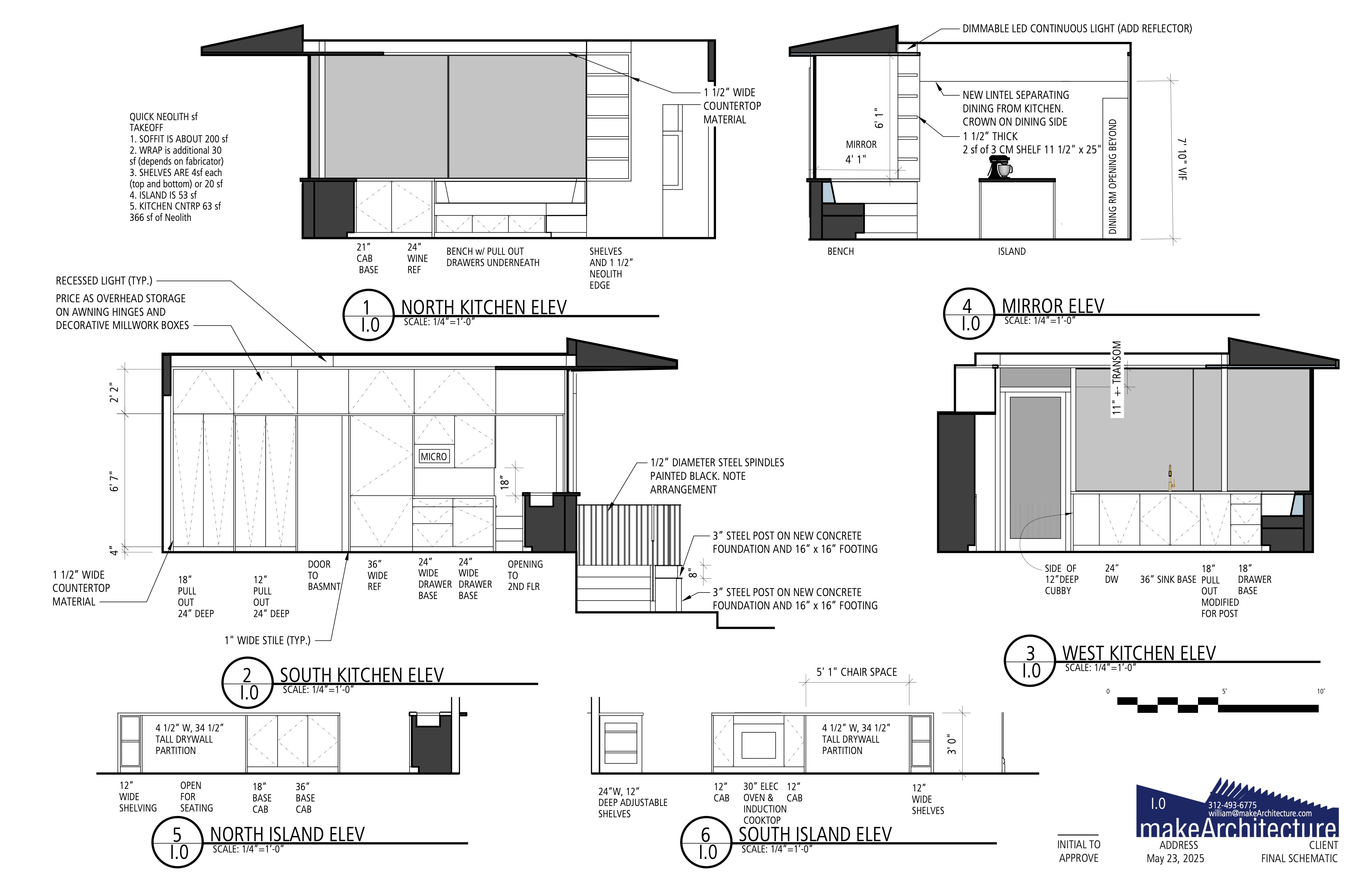
The kitchen is housed in a 120 sf or so addition and has large sliding glass windows on a countertop that extends from inside to outside. They frame views of the lake and the neighbors' beautiful homes. Like a lot of our work, this takes research, history, zoning skills, structural engineering ability and a lot of problem solving in search of simple, elegant, beautiful solution created with the feedback of our client when we posed them the question.
"How do you want to live?"
Here's their answer. Yes, it's our design but it's really their composition.
Evanston Lakeshore Historic District
#sanbornmaps #evanston #evanstonlakefront #lakeshorehistoricdistrict #evanstonkitchen #evanstonkitchendesign #wilmettekitchen #winnetkakitchen
We use Sanborn maps on a regular basis. What are they?
"Sanborn maps are detailed maps of U.S. cities and towns in the 19th and 20th centuries. Originally published by The Sanborn Map Company, the maps were created to allow fire insurance companies to assess their total liability in urbanized areas of the United States." from Wikipedia.
We were doing a small addition for a new kitchen on a beautiful house fronting Lake Michigan. There were some peculiar aspects of the lot such as the garage was connected by the walkway width of a sliver of land at the alley. The 1899 map shows a house smaller than the present day one and it appears to be older than the others. Portions of the original lot were sold off and by 1920 the house is crowded between more neighbors.
The kitchen is housed in a 120 sf or so addition and has large sliding glass windows on a countertop that extends from inside to outside. They frame views of the lake and the neighbors' beautiful homes. Like a lot of our work, this takes research, history, zoning skills, structural engineering ability and a lot of problem solving in search of simple, elegant, beautiful solution created with the feedback of our client when we posed them the question.
"How do you want to live?"
Here's their answer. Yes, it's our design but it's really their composition.
Evanston Lakeshore Historic District
#sanbornmaps #evanston #evanstonlakefront #lakeshorehistoricdistrict #evanstonkitchen #evanstonkitchendesign #wilmettekitchen #winnetkakitchen